I like a river walk that can survive a change of mood. You can stop after one bridge, sit over a drink or keep going when the light improves. This stretch of the Seine offers that freedom without asking you to book a cruise or enter a museum.
- Start
- Pont Neuf, at street level
- Finish
- Musée d'Orsay riverfront
- Allow
- About 90 minutes at my suggested slow pace
- Route choice
- Upper pavements; lower quays optional
THE ROUTE, AT A GLANCE
- Pont NeufOrient yourself above the western end of Île de la Cité.
- Quai de ContiFollow the left bank west, with the river on your right.
- Pont des ArtsPause on the pedestrian bridge, or finish the shorter walk here.
- Pont RoyalDecide whether to continue along the riverfront.
- Musée d'Orsay frontageAn outdoor finish; museum admission is a separate plan.
An outline to adapt on the day. Allow for access, weather, and your own pace.
At Pont Neuf, learn one direction
Start on Pont Neuf and take a moment to understand the island beneath you. The western tip of Île de la Cité points downstream; the river divides around it and opens towards the Louvre. That is the direction of this walk. You do not need a detailed knowledge of Paris to begin, only a sense of which way the water and the next bridge lie.
Paris je t'aime describes Square du Vert-Galant below the bridge as a place to look towards the Louvre and the Institut de France. It is an optional detour, not the required start. If descending and climbing back up would be inconvenient, enjoy the view from bridge level and continue. The route remains complete without touching the water's edge.
Stay with the left bank towards Pont des Arts
From the southern end of Pont Neuf, head west along the street-level pavement beside Quai de Conti. Keep the river to your right. This simple instruction is the backbone of the outing. At junctions, use marked crossings and pause somewhere that leaves room for people passing; a good view does not make the pavement a private viewing platform.
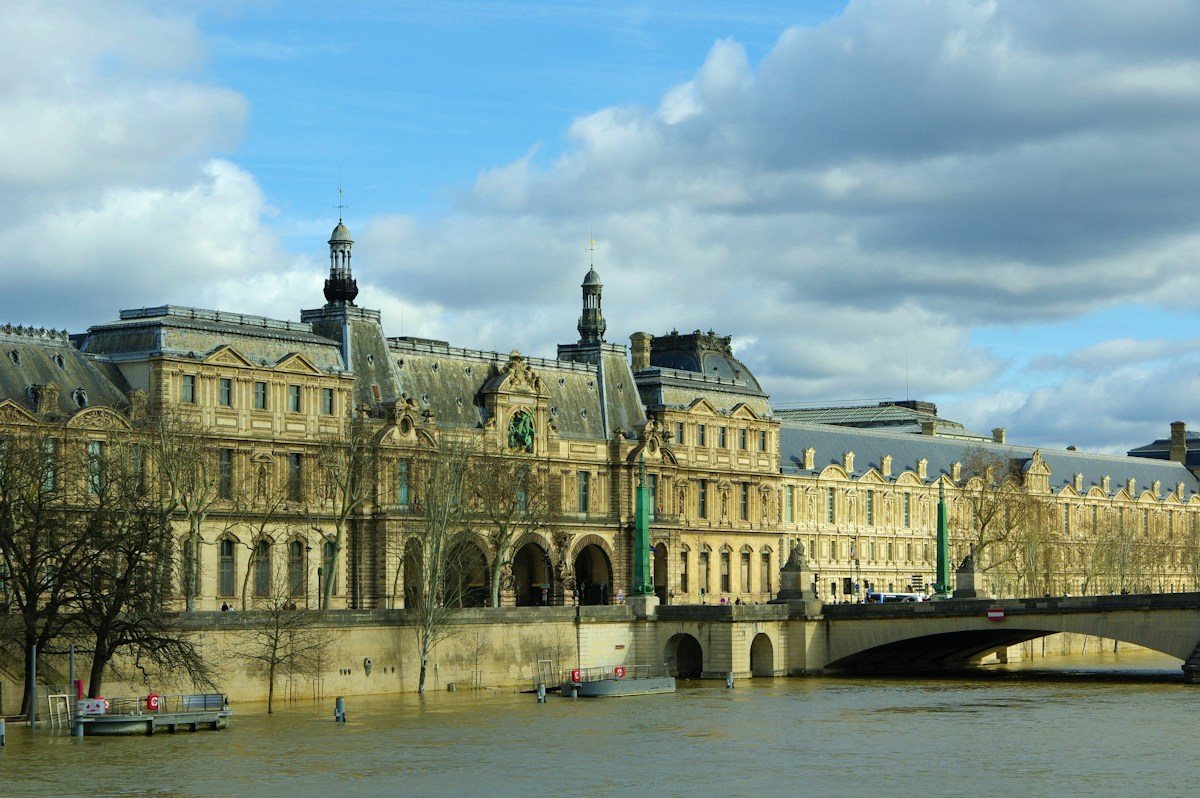
Pont des Arts is the first natural pause. Step onto the pedestrian bridge if you wish, then return to the same bank to continue. My interest here is the changing relationship between buildings and water: the island recedes, the Louvre becomes a long presence across the river, and the dome on the left bank gives you another point of reference.
There are two different walks beside this river
A Seine itinerary often treats the upper pavement and the lower quay as though they were interchangeable. They are not. Street level keeps you near crossings, cafés and routes back into the city. Lower sections can feel removed from traffic but require you to identify a usable way down and another way up. That distinction matters more than a photograph suggests.
The City of Paris documents the transformation of former riverbank roads into Parc Rives de Seine. Its account describes pedestrianised stretches on both banks, a real public-space project rather than a hidden attraction. I take that as an invitation to linger, not a promise that every metre beside the water is open, level or accessible on the day you visit.
My default is to remain on the upper route. Add a lower-quay section only after checking access signs and the exit ahead. Anyone needing a step-free route should verify individual ramps, surfaces and current restrictions; this suggested walk has not been audited as a continuous accessible itinerary.
Let Pont Royal be the decision point
Continue west through Quai Malaquais and Quai Voltaire towards Pont Royal. The opposite-bank view changes as you move past the Louvre towards the Tuileries side. There is no advantage in hurrying between the bridges. Choose one stretch to watch a boat pass, notice reflections or simply put the map away while the route remains obvious.
At Pont Royal, decide whether you want more river. The Musée d'Orsay frontage lies a little farther west along Quai Anatole France and makes a clear outdoor finish. Going inside is a separate museum visit with its own ticket and opening arrangements. I would not add it casually to a walk simply because the entrance is nearby.
A different version for a damp afternoon
Imagine arriving at Pont Neuf after lunch with intermittent rain and only an hour before meeting a friend. This is a planning example: keep to street level, make Pont des Arts your main pause and end when you reach a convenient café. The value is the sequence of river views, not proving that you reached the final pin.
There is a practical reason to keep the upper route in mind. The city explains that riverbank sections can close during high water and reopen only when conditions and cleaning allow. A closed barrier is the end of that option. Follow the posted diversion instead of trying to squeeze around it for an uninterrupted waterfront photograph.
Leave the river before you are tired of it
Before setting out, save a return route from both Pont des Arts and the Orsay area. That gives the walk two legitimate endings. If the weather is kind, you can enjoy the longer version; if your feet disagree, the shorter version still has a beginning, a view and a sense of Paris's shape.
A FEW USEFUL ANSWERS
Frequently asked questions
Do I need to go down to the lower quays to enjoy this walk?
No. The suggested route works from the upper pavements and bridge level. Lower sections are optional and depend on available access and conditions. Staying above the river also makes it simpler to stop at a café or leave the route. Choose the level that suits your mobility and the day's weather.
Is the whole route suitable for a wheelchair or pushchair?
This is not a verified continuous step-free route. Check the specific pavement sections, crossings, ramps and temporary restrictions that matter to you. Avoid assuming that a lower-quay entrance has a suitable exit farther along. The optional Square du Vert-Galant detour can be omitted without losing the main river views.
Can I add the Louvre or Musée d'Orsay on the way?
You can plan a separate museum visit, but allow it its own time and booking arrangements. The walk uses exterior views, not museum admission. If you already have a timed ticket, build the walk around that entrance instead of treating a major collection as an incidental stop between two bridges.
What should I do if the river path is closed?
Follow the closure and any signed diversion. High water can make lower riverbank sections unavailable, and reopening may require cleaning after the water falls. Keep a street-level alternative and shorten the walk when necessary. There is no need to find a way around barriers to preserve the original route.
Sources & useful links
Checked 29 October 2026. Confirm opening times, fares, and booking conditions with the operator before setting out. Published experiences belong to the people credited below.
- Paris je t'aime — the central islands and Square du Vert-Galant ↗
- City of Paris — Parc Rives de Seine and its pedestrian riverbanks ↗
- City of Paris — high water, riverbank closures and reopening ↗